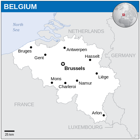
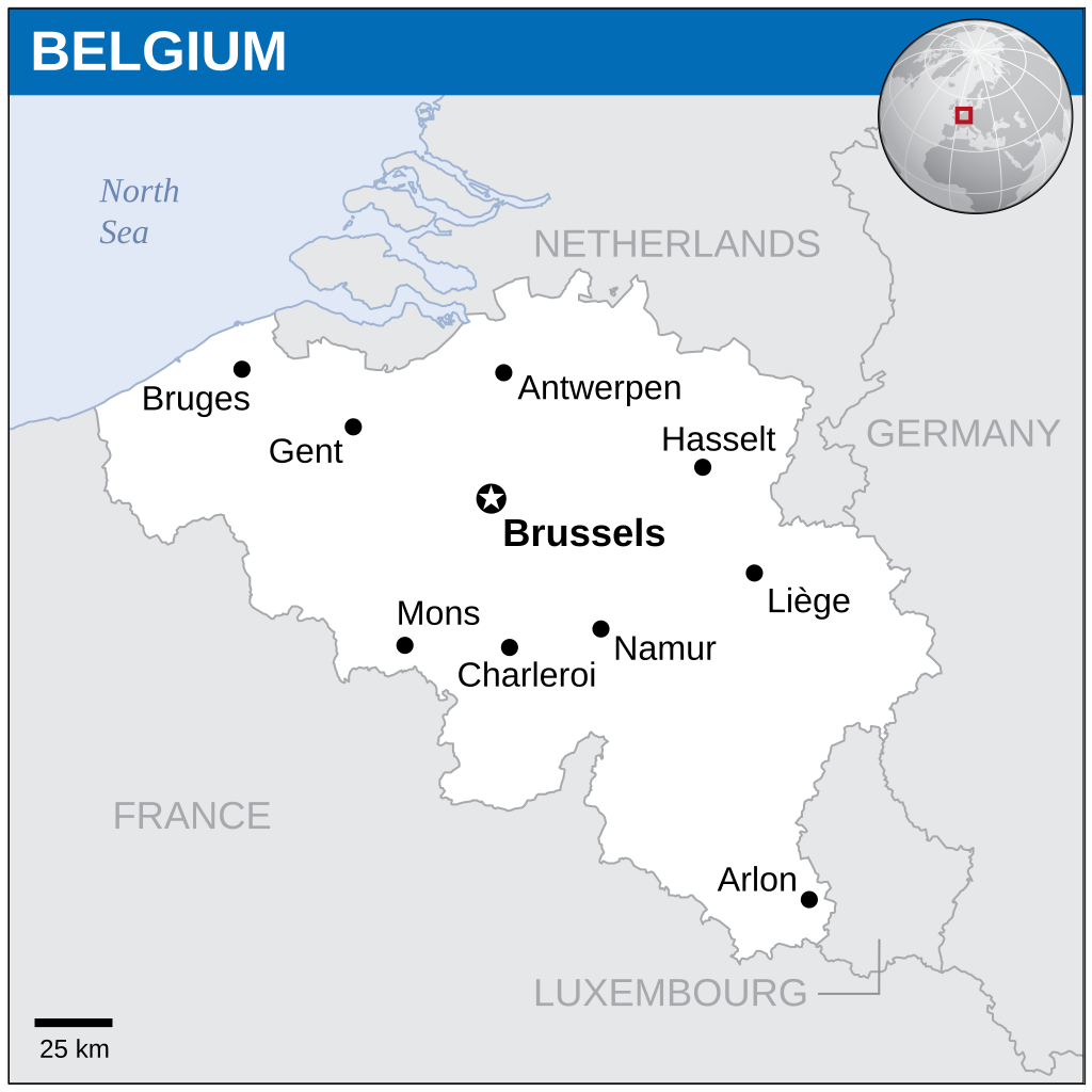
Fitxategi:Belgium - Location Map (2013) - BEL - UNOCHA.svg

Jatorrizko fitxategia (SVG fitxategia, nominaldi 254 × 254 pixel, fitxategiaren tamaina: 905 KB)
_-_BEL_-_UNOCHA.svg)
Laburpena
| Deskribapena |
English: Locator map of Belgium. |
| Data | |
| Jatorria |
English: Belgium Locator Map (ReliefWeb), ESRI, UNCS |
| Egilea | |
| SVG genesis | Fitxategi hau (bektore-irudia) hau Inkscape-ekin sortu da .
. |
Lizentzia
- Askea zara:
- partekatzeko – lana kopiatzeko, banatzeko eta bidaltzeko
- birnahasteko – lana moldatzeko
- Ondorengo baldintzen pean:
- eskuduntza – Egiletza behar bezala aitortu behar duzu, lizentzia ikusteko esteka gehitu, eta ea aldaketak egin diren aipatu. Era egokian egin behar duzu hori guztia, baina inola ere ez egileak zure lana edo zure erabilera babesten duela irudikatuz.
 This map is part of a collection of 216 free country maps, created by the UN Office for the Coordination of Humanitarian Affairs (OCHA), to be used in print, web or broadcast products.
The ReliefWeb Location Maps released here are maps that highlight a country, its capital, major populated places and the surrounding regions. Attribution Requirements
Using the map without modifications: ensure that the sources and the disclaimer are below the map. Credit as follows: "Credit: OCHA". For use with alteration: remove the OCHA logo and disclaimer following any modification to the map, but keep the data sources as mentioned below the map. Credit the modified map as follows: "Based on OCHA map". You are responsible for the content of your map. We are keen to receive your feedback and hear how you used OCHA's maps. We would be grateful if you would notify us by e-mail and share your work with us. UN Disclaimer
The designations employed and the presentation of material of this map do not imply the expression of any opinion whatsoever on the part of the Secretariat of the United Nations concerning the legal status of any country, territory, city or area or of its authorities or concerning the delimitation of its frontiers or boundaries. |
Fitxategiaren historia
Data/orduan klik egin fitxategiak orduan zuen itxura ikusteko.
| Data/Ordua | Iruditxoa | Neurriak | Erabiltzailea | Iruzkina | |
|---|---|---|---|---|---|
| oraingoa | 19:21, 4 otsaila 2024 | | 254 × 254 (905 KB) | wikimediacommons>Illchy | File uploaded using svgtranslate tool (https://svgtranslate.toolforge.org/). Added translation for id. |
Fitxategiaren erabilera
Fitxategi hau darabil ondorengo orri honek:
_-_BEL_-_UNOCHA.svg)