Fitxategi:Italy topographic map-blank.svg
Nabigaziora joan
Bilaketara joan


SVG fitxategi honen PNG aurreikuspenaren tamaina: 487 × 600 pixel. Bestelako bereizmenak: 195 × 240 pixel | 390 × 480 pixel | 623 × 768 pixel | 831 × 1.024 pixel | 1.662 × 2.048 pixel | 1.759 × 2.167 pixel.
Jatorrizko fitxategia (SVG fitxategia, nominaldi 1.759 × 2.167 pixel, fitxategiaren tamaina: 1,98 MB)

Laburpena
| Deskribapena |
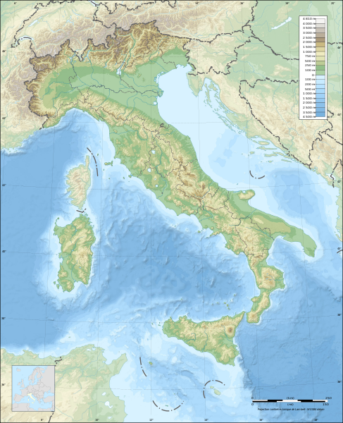
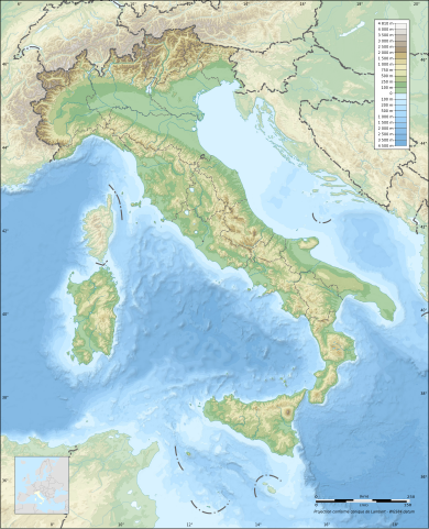
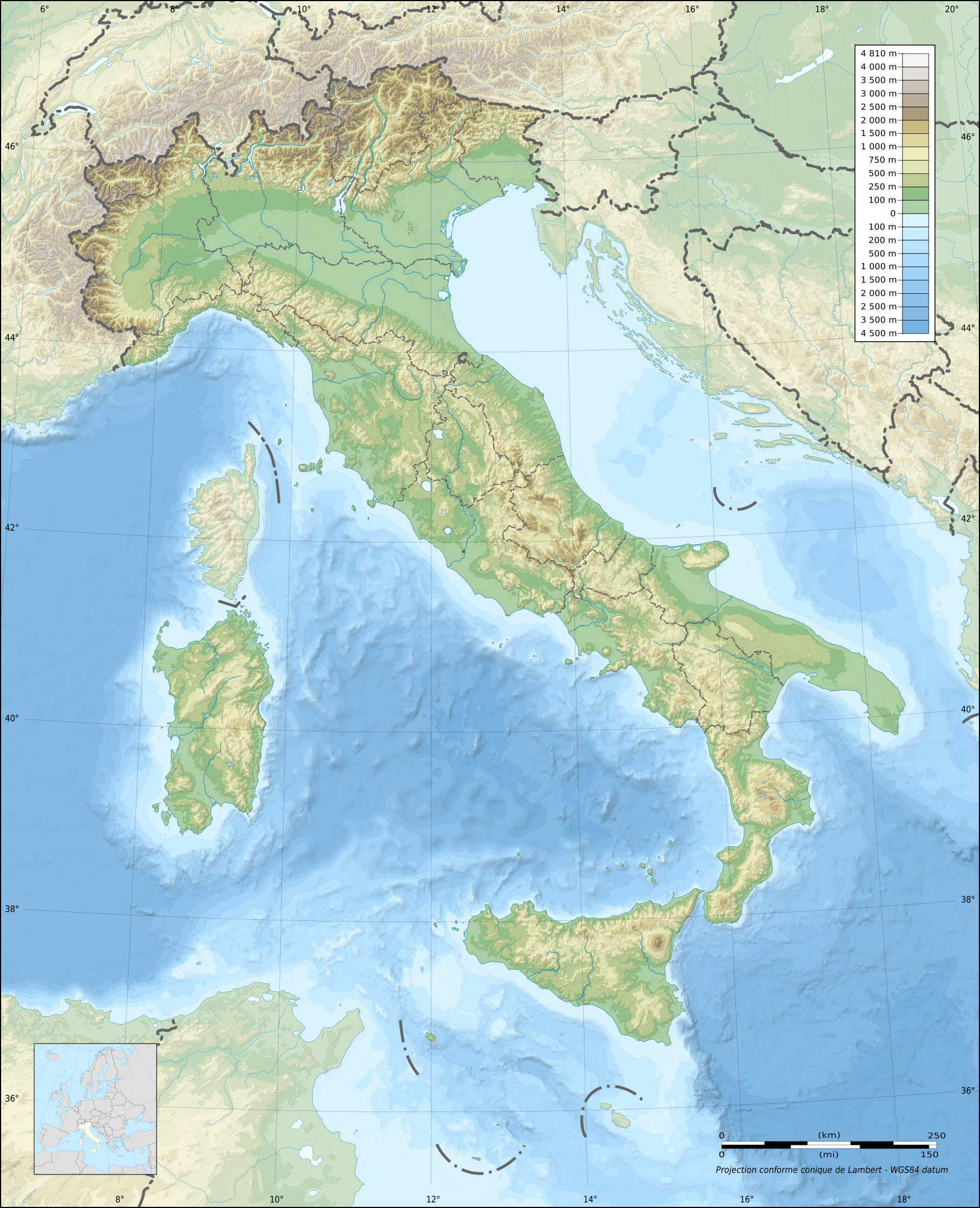
English: Blank topographic map of Italy, with regions boundaries and including the 08-2009 modification of the boundary between Emilia-Romagna and Marches regions.
Note: The background map is a raster image embedded in the SVG file. Français : Carte topographique vierge de l'Italie, avec limites des régions et intégrant la modification d'août 2009 de la frontière entre les régions Emilia-Romagna et Marches.
Note : Le fond de carte est une image bitmap embarquée dans le fichier SVG. Deutsch: Topografische Karte Italiens, mit den Grenzen der Regionen (einschließlich der Änderungen im August 2009 zwischen den Regionen Emilia-Romagna und Marken) ohne Beschriftung. Hinweis: Der Hintergrund ist ein Rasterbild, eingebettet in die SVG-Datei. Lambert conformal conic projection; WGS84 datum
|
| Data | |
| Jatorria |
Norberak egina
|
| Egilea | Eric Gaba (Sting - fr:Sting) |
| Lizentzia (Fitxategi hau berrerabiltzen) |
Fitxategi hau Creative Commons Attribution-Share Alike 3.0 Unported lizentziapean dago.
|
| Beste bertsioak |
Derivative works of this file:
|

| Attribution and Share-Alike required |
|---|
| Any use of this map can be made as long as you credit me (Eric Gaba – Wikimedia Commons user: Sting) as the author, User:NordNordWest for the regions boundaries, and distribute the copies and derivative works under the same license(s) that the one(s) stated below. A message with a reply address would also be greatly appreciated. |
| Kameraren kokapena | | Irudi hau eta gehiago beraien kokapenekin hurrengo lekuetan: OpenStreetMap |
|---|
Lizentzia
Nik, lan honen egileak, argitaratzen dut ondorengo lizentzia hauen pean:

|
Baimena duzu dokumentu hau kopiatu, banatu edo/eta aldatzeko GNU Free Documentation License baldintzapean, Free Software Foundationek argitaratutako 1.2 edo ondorengo bertsioan; sekzio aldaezinik gabe, azaleko testurik gabe, eta atzeko azaleko testurik gabe. Lizentziaren kopia dago GNU Free Documentation License izenburudun atalean. |
Fitxategi hau Creative Commons Attribution-Share Alike 3.0 Unported lizentziapean dago.
- Askea zara:
- partekatzeko – lana kopiatzeko, banatzeko eta bidaltzeko
- birnahasteko – lana moldatzeko
- Ondorengo baldintzen pean:
- eskuduntza – Egiletza behar bezala aitortu behar duzu, lizentzia ikusteko esteka gehitu, eta ea aldaketak egin diren aipatu. Era egokian egin behar duzu hori guztia, baina inola ere ez egileak zure lana edo zure erabilera babesten duela irudikatuz.
- berdin partekatu – Lan honetan oinarrituta edo aldatuta berria eraikitzen baduzu, emaitza lana hau bezalako lizentzia batekin argitaratu behar duzu.
Nahiago duzun lizentzia erabil dezakezu.
Fitxategiaren historia
Data/orduan klik egin fitxategiak orduan zuen itxura ikusteko.
| Data/Ordua | Iruditxoa | Neurriak | Erabiltzailea | Iruzkina | |
|---|---|---|---|---|---|
| oraingoa | 23:13, 17 uztaila 2010 | | 1.759 × 2.167 (1,98 MB) | wikimediacommons>Sting | Oups! Not the correct background |
Fitxategiaren erabilera
Fitxategi hau darabil ondorengo orri honek: